OM ASTHA RAI KATHMANDU, Aug 25: The inhabitants of Surkhet, a district in Nepal´s mid-western region, were recently struck by what was arguably the worst flooding in living memory. The death toll from the Surkhet flood, caused by the downpour that continued for two days in the second week of August, has reached 33, excluding 99 people still missing and thereby feared dead, so far, according to the National Emergency Operation Center (NEOC). Around the same time, devastating floods struck other districts of the mid-western region like Bardiya and Dang, too. So, what led to such disastrous floods throughout the whole region? “Such a heavy downpour is unprecedented,” says Mahesh Gautam, president of Nepal Red Cross Society, Bardiya. “We had never before witnessed such intense rainfall.” 
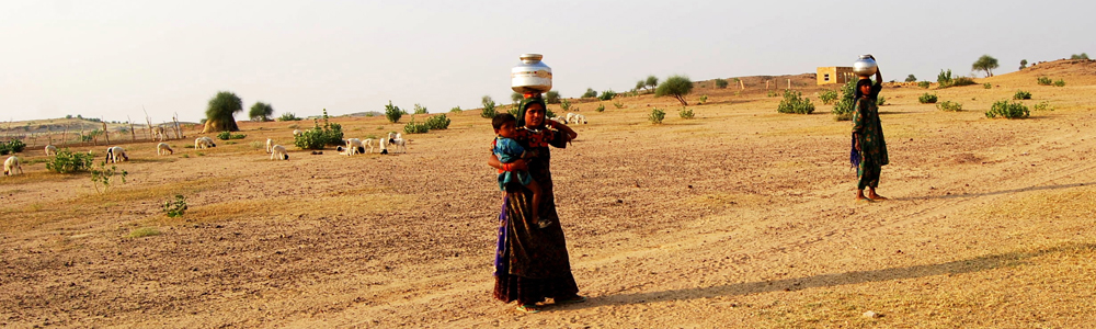
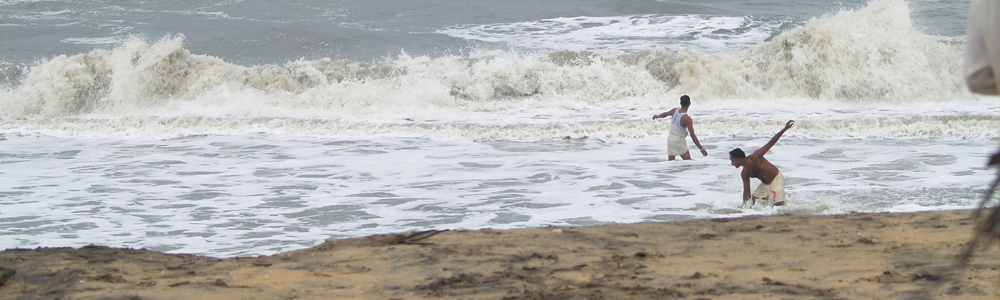
Banke flood victims heading for higher grounds along with their belongings last week. (Republica) According to the Meteorological Forecasting Division (MFD), more than 150 mm of rainfall was recorded in eight different districts of the midwestern region during a short period of just 24 hours ending at 8:45 in the morning of August 15. In other regions of the country, no more than 100 mm rainfall was recorded during that same period. “If 150 mm rainfall is recorded in some particular area in such a short period, we generally anticipate devastating flooding,” says Gautam. “But, in some places like Surkhet, even more than 400 mm of rainfall was recorded around that same time. It was something we never witnessed before. Even the elderly people in our community do not remember if they had witnessed such a heavy downpour before.” The MFD officials say some rain data recorded in the midwestern region this year are record-making. Ever since it started keeping rain data in 1969, the MFD had never recorded 423 mm of rainfall in just 24 hours in Surkhet. Similarly, 298 mm of rainfall recorded in Dang during the same period is highest of all time. “Rains were intense this year in the midwestern region,” says Barun Poudel, a meteorologist at the MFD. “In our recent memory; we had not seen such an extreme weather event.” Scientists say climate change causes extreme weather events, among other things. The term ´too much rain or too less rain´ is often used to explain the effects of climate change in the simplest way. The United Nations International Panel on Climate Change (IPCC) has unequivocally stated that climate change is already causing extreme weather events. So, can the intense rainfall of the midwestern region be described as a result of climate change? “Theoretically, yes,” says Dr Arun Bhakta Shrestha, a senior climate change specialist at the International Center for Integrated Mountain Development (ICIMOD). “This is what climate change causes. But, we cannot say surely without proper research.” Dr Shrestha says climate change increases frequency and magnitude of extreme weather events, meaning that Nepal could face in future more of what led to the devastating floods and landslides of the midwestern region. “It is a wake-up call,” says Dr Shrestha. “We now need to better mitigate climate change and better adapt to its effects.” However, what happened in the midwestern region during and after the flooding has demonstrated that Nepal is yet unable to deal with disasters. When floods ravaged much of the region, early warning system collapsed, embankments gave way and government authorities fell short of resources to rehabilitate the displaced families. In Bardiya, thousands of families living along the Babai River were confident that an early warning station set up to the north of their villages would alert them in case of a disastrous flood. But, the locals living south of Chepang village, where the station was placed to gauge the water level in the Babai River, had no inkling that the flood was about to wash away everything they had. The station failed right at the moment when it was needed the most. “We had not anticipated such a worse flood in Babai,” says Rajendra Sharma, chief of Flood Forecasting Project at Department of Hydrology and Meteorology (DHM). “The very first wave of flood swept away our station; and people were caught unguarded.” Gautam, the Bardiya Red Cross president, says, “We need better early warning system as climate change poses more serious threats of extreme weather events.” |
||
Published on 2014-08-26 02:42:03
|
Monthly Archives: August 2014
Nepal’s disaster preparedness woefully inadequate
OM ASTHA RAI KATHMANDU, Aug 21: Nepal has put in place plenty of plans, strategies and mechanisms to deal with disasters in the last five years. But, is Nepal now well-prepared to manage disasters? The answer is a big NO. In the aftermath of the recent Sunkoshi landslide and other devastating floods, particularly in the plains of the midwestern region, it seems that Nepal´s disaster preparedness is almost non-existent. Zero mitigation Government officials often dub 2009 as a landmark year in the field of disaster risk management. On October 11 that year, the government approved a national strategy for disaster risk management, outlining top five priority areas. In the years since 2009, several mechanisms, as envisioned by the national strategy, have been formed to manage disasters. Water trapped by the August 2 landslide in the Sunkoshi River flows from two outlets dug in Mankha VDC of Sindhupalchowk district on Thursday. The water level in the trapped river had dropped by a meter and a half by Thursday. Nepal Army, which is involved in draining out the water, said it aims to reduce the water level by 15-20 meters. (Dhurva Dangal/Republica) First of all, a consortium for disaster risk reduction was formed. The consortium, led by the home secretary, consists of development partners supporting Nepal´s disaster preparedness programs; and provides required financial and technical assistance. Also, disaster response networks and search and rescue strategies have been prepared. The Ministry of Federal Affairs and Local Development (MoFALD) has also formed disaster management committees in many districts and villages. So, despite all this preparedness, why did the recent floods cause so much damage in the mid-western region? According to the National Emergency Operation Center (NEOC) of the Ministry of Home Affairs (MoHA), floods and landslides have killed 123 people, injured 67 people and left 126 people missing in several parts of the country since August 14. In the same floods and landslides, 9,954 houses were completely damaged, 10,361 houses partially damaged, and 11,205 houses were inundated, and 20,245 families were displaced. Although the recent floods and landslides have hit as many as 25 districts, Surkhet, Dang and Bardiya are the worst affected ones. Why did Nepal´s disaster management plans, programs, trategies and mechanisms fail to reduce the damages caused by the recent floods and landslides? “Perhaps, our disaster preparedness is far from adequate,” says Ramesh Shrestha, an early warning system officer at Mercy Corps Nepal, an NGO working in disaster management sector. Shrestha believes that there is no gap in disaster management policies and strategies but their implementation is far from satisfactory. “This is why disasters continue to cause so much destruction every year,” says Shrestha. Ram Chandra Neupane, chairman of ECO-Nepal, another NGO working in disaster management sector, says, “In our plans, programs and strategies, we have focused on how to respond to disasters. But, we have failed to focus on how to mitigate risks of disasters.” Neupane says mitigation is as important as responsiveness or even more so. “Unless mitigation is prioritized, response will always be insufficient,” says Neupane. Constructing embankments along rivers is one of the most important aspects of mitigating the risk of floods. But, even flood-prone rivers are without embankments and flowing waywardly, killing people, damaging houses and displacing families every year. This year, Babai River swelled up, changed its course and caused devastation in a vast area of fertile land – somewhere as far as five kilometers from the original water course. Although Babai is and was always a flood-prone river, the government has not built a strong embankment along its serpentine course so far. Only a few months before the onset of monsoon, temporary embankments were built in some parts of Babai River, which were washed away by the flood. “Had there been a strong embankment along Babai River, damage would have been far less in Bardiya,” says Shrestha. “This is one area where our disaster management plans have failed.” Poor response Even in terms of responsiveness, Nepal does not look well-prepared. As part of Nepal´s flood forecasting project, nearly two dozen flood measurement stations have been set up. But, the recent floods showed these stations are too few and far between. In Babai River, the flood washed away the entire early warning system. In the flood-ravaged villages, the displaced people have no place to sleep, no warm clothes to wear. They have been given rice. But, without kitchen utensils and fuelwood, they are unable to cook their meals. According to the NEOC, the government has distributed more than Rs 1.6 million as relief money to the flood victims. But, that seems too little. “The recent floods and landslides showed that we are yet not prepared to deal with big disasters,” says Mahesh Gautam, president of Nepal Red Cross Society, Bardiya. “We need to go a long way in disaster preparedness sector.”
|
||
Published on 2014-08-22 02:07:15
|
Sunkoshi tragedy exposes failure in hazard mapping
OM ASTHA RA KATHMANDU, Aug 7: The landslide that killed more than 150 people and blocked the Sunkoshi River last Saturday at Mankha village of Sindhupalchowk district has exposed yawning gaps in Nepal´s hazard mapping and early warning mechanisms. Hours before the dawn of August 2, a massive landslide occurred, creating a huge debris dam that completely blocked the course of the Sunkoshi River for over 12 hours. Only after a Nepal Army (NA) team created a channel through controlled explosions, some of the blocked water started flowing downward. However, almost a week later, the dam is still there, posing flood threats to people living downstream. As per a report released by the International Center for Integrated Mountain Development (ICIMOD), a 1.9 km long slope of land perched 1,350 meters above the river bed collapsed in Jure area of Mankha village, burying around two dozen houses. Within the first three days of the disaster, rescuers recovered 33 dead bodies from under the rubble. On the fourth day, the government declared all 123 missing people dead. Nepal Army soldiers perched atop rocks in the Sunkoshi River as they set up ropes for possible rescue efforts in view of the continuing threat of flooding.(Phot Couresy: Nepal Army) Immediately after the Sunkoshi landslide, the government declared downstream villages along the river a flood emergency zone and evacuated more than 100 vulnerable families from the area. As days passed, normalcy seems to be slowly returning to downstream villages. With the NA team trying to release more water through controlled explosions, a lurking crisis seems to have been averted. However, the Sunkoshi disaster could just be a wake-up call. If serous efforts are not undertaken, immediately, more such disasters could strike Nepali villages in future, say experts. Haphazard settlements In Larcha, a little village located between Tatopani and Fulping Katti VDCs of Sindhupalchowk, a massive landslide had occurred in 1996, sweeping away dozens of houses. However, the landslip-affected families resettled in the same village. The Larcha landslide is a testimony to how hundreds of thousands of families are haphazardly living in flood and landslide prone villages. They are often struck by floods and landslides but continue to live there. Worse, the government has no plans and programs to identify flood and landslide prone villages and rehabilitate people from there. Even in Jure, the hill where the Sunkoshi landslide occurred had collapsed around 60 years ago, according to Amrit Kumar Bohara, a CPN (UML) leader who witnessed the disaster when he was just a six-year-old child. But, the locals of Jure neither relocated to safer locations nor the government ever tried to evacuate them. Suresh Nepal, who was Vice President of the Sindhupalchowk District Development Committee (DDC) when the Larcha landslide occurred, says, “People always want to live near the road even though there is constant fear of flooding and landslides. This is why the locals in Larcha and Jure did not move elsewhere even after being struck by landslides in the past.” It is not just the locals who choose to overlook the threats of possible disasters. Even big companies have built hydropower plants fully knowing the risks of possible floods and landslides. Along the Sunkoshi (Bhotekoshi) River, there are at least three major hydro power plants apart from many other micro hydropower projects. “Some people know the risks but are too poor to go elsewhere,” says Arun Bhakta Shrestha, a senior climate change specialist at the ICIMOD. “But, if you look at houses built along the Sunkoshi River, it would be hard to say that all the locals are poor and therefore incapable of moving elsewhere. In fact, they take calculated risks. So do hydropower companies.” Risks can be reduced The Sunkoshi river basin is vulnerable to Glacial Lake Outburst Floods (GLOF) and Landside Dam Outburst Floods (LDOFs). In the last 30 years, one GLOF and two LDOF events, excluding the August 2 tragedy, have already occurred in this region. After a GLOF event in 1981, the level of the Araniko Highway was raised and taller bridges were built in an effort to minimize damages that future GLOF and LDOF events could cause. Beside, early warning system was set up by the Bhote Koshi hydropower plant. What was done in the wake of the 1981 GLOF needs to be scaled up, say experts. They say hazard mapping and early warning system need to be developed not only in the Sunkoshi basin but across the country. “Although we cannot control natural hazards like landslides and floods, there are many things that can be done to minimize their adverse impact on lives, livelihoods, and valuable infrastructure,” says the ICIMOD report on the Sunkoshi landslide. “More efforts to map landslide risks are needed, and much more frequent monitoring of potential landslide sites is necessary.” Can what the ICIMOD report recommends be done? “It is not a question of whether we can,” says Dr Shrestha. “We can and we must do it. If we cannot do it across the country at one once, let us start it from the most vulnerable village. But, let us do it right now.” |
||
Published on 2014-08-08 03:06:2
|
http://www.myrepublica.com/portal/index.php?action=news_details&news_id=80510
Combating climate change through forest conservation
OM ASTHA RAI
When he was a young farmer, Chandra Bir Kumal, a resident of Gobardiya village in Dang district, never had to rely on water stored in artificial reservoirs for rice plantation. He always used fresh water freely flowing through local streams.
“I do not know whether fresh water is better than stagnant water,” says Chandra Bir. “But, when I was active in farming, I never had to look for alternatives. I used to get a plenty of rainwater.”
Affectionately called by the local folks as Thula Ba (or the eldest villager), Chandra Bir is one of the first Kumals who settled in Banmari area of Gobardiya village. Later, many other Kumals, one of Nepal’s minority indigenous communities, settled down there. Today, the whole Banmari area is known as Kumal Gaun.
OM ASTHA RAI
Combating climate change through forest conservation
When he was a young farmer, Chandra Bir Kumal, a resident of Gobardiya village in Dang district, never had to rely on water stored in artificial reservoirs for rice plantation. He always used fresh water freely flowing through local streams.
“I do not know whether fresh water is better than stagnant water,” says Chandra Bir. “But, when I was active in farming, I never had to look for alternatives. I used to get a plenty of rainwater.”
Affectionately called by the local folks as Thula Ba (or the eldest villager), Chandra Bir is one of the first Kumals who settled in Banmari area of Gobardiya village. Later, many other Kumals, one of Nepal’s minority indigenous communities, settled down there. Today, the whole Banmari area is known as Kumal Gaun.
Nearly five decades ago, when Chandra Bir and a few other Kumal families started living in Banmara, chopping trees and fighting malaria, they did not have irrigation facilities. All they had was rainwater. And it was sufficient and reliable. “We did not need water reservoirs,” says he. “We did not even think of building them.”
However, as years passed by, rains started to get erratic. It became increasingly difficult to predict when monsoon would start and end. “It was not like this when I was young,” says Chandra Bir. “Then, the monsoon would normally start and end around the same time.”
As Chandra Bir aged and became too weak to work, his son Kalpa Ram, shouldered the burden of cultivating their eight kattha of farm land. But unlike in the time of his father, Kalpa Ram, now 50-year-old, did not find it easy to irrigate their farm land with rainwater. “If the monsoon arrives early this year, it gets late the next year,” says Kalpa Ram. “Rains are no longer predictable, no longer reliable.”
Fortunately, Kalpa Ram no longer needs to depend on just rainwater. He gets water supply for irrigation from a local pond. Built by a local Community Forest Users’ Group (CFUG), of which Kampa Ram is a member, this pond regularly supplies water to more than 200 families of Gobardiya village. “If this pond was not built, we all would have to leave this village a long ago,” says Kalpa Ram.
To see the full story, please click the link below:
http://theweek.myrepublica.com/details.php?news_id=80537
New wildfire soot variety could upset all global warming estimates
[http://www.natureasia.com/en/nindia/article/10.1038/nindia.2014.101]
Subhra Priyadarshini
Soot from wildfires across the world could actually be causing far more warming than our climate models account for. Hidden away from all scientific estimates is a newly-discovered form of soot – the ‘superaggregates’ – emitted from wildfires. Scientists have found that this kind of soot causes 90 per cent more warming than conventional sub-micrometer soot particles.
WWT
The superaggregates came into light when scientists from the Desert Research Institute in Nevada-Reno, USA, were studying the massive 2012 wildfire in the Nagarhole National Forest of Karnataka. Studying aerosol samples over the Indian Ocean at the Maldives Climate Observatory on Hanimaadhoo Island, they found a new type of soot particle almost 10 times longer than normal and far more compact in shape than the sub-microscopic variety.
1. Chakrabarty, R. K. et al. Soot superaggregates from flaming wildfires and their direct radiative forcing.Sci. Rep. (2014) doi: 10.1038/srep05508
Extra-terrestrial solar event triggered Uttarakhand cloudburst
[http://www.natureasia.com/en/nindia/article/10.1038/nindia.2014.98]
Subhra Priyadarshini
Unplanned human activities in the Himalayan terrain coupled with some unusual extra-terrestrial events triggered the massive cloudburst over Kedarnath resulting in the catastrophic 2013 floods in Uttarakand region of India, according to new research.
JNU
NASA’s Sun Observatory Heliospheric Observatory (SOHO) satellite recorded a steep rise in solar proton flux above 10 MeV for 12 days from May 15 to 26). During the same period, the cosmic ray intensity was also recorded at an all-time high at New Delhi’s Jawaharlal Nehru University (JNU), which represents the regional cosmic ray data in the Space Environment Viewing and Analysis Network (SEVAN) of the Asian office of Aerospace Research.
1. Mukherjee, S. Extra terrestrial remote sensing and geophysical applications to understand Kedarnath cloudburst in Uttarakhand, India. J. Geophys. Remote Sens. (2014) doi: 10.4172/2169-0049.1000124
Climate change policy: What’s new for Asia?
At a workshop discussing what the take homes for Asian countries might be from the latest assessment report of the Intergovernmental Panel on Climate Change (IPCC) — AR5 — it was pointed out that there wasn’t enough science coming out of developing countries to feed the database on emissions or warming in the larger climate change debate. Local scientists need to conduct more climate change related experiments, write more scientific papers and bolster regional science in order to make a case for these developing countries in the international discourse on climate change.
“We also need more authors from the developing world to participate in writing the chapters for the IPCC reports,” says Jonathan Lynn, Head of Communication at the IPCC. Lynn says though there is substantial science emanating from India now, some other small Asian countries such as Indonesia lag far behind. The IPCC collates scientific data from across the world to make predictions for future scenarios with the help of scientists, economists, policy makers and government representatives. Most of the work done by scientists in this process is voluntary and not paid for. Developing country scientists, who also do consultancy work for a living, would expect such work to pay off for their time — this could be one of the reasons why not many developing country scientists are interested in the job, Lynn says.
The IPCC assessment reports try to turn all available scientific evidence into something that would make sense to policy makers and businesses — therefore, the authors have explained the science at hand this time in terms of “risk management” parameters. “And since there are questions of ethics and equity involved in this highly political debate, we now have philosophers in the IPCC team to make sure those aspects are taken care of,” Lynn says.
Joyashree Roy, an economist from the Jadavpur University in Kolkata is the lead author of the industry chapter in IPCC’s assessment report five. She says Asia needs to urgently decouple the high energy sector from emissions. “Almost 44 per cent of the global emissions are from the energy and industry sectors of China and India — there lies an opportunity for south Asia. Can we think of a low emission-high energy scenario?”
Roy says population and economic growth are responsible for the surge in energy demand as well as emissions in south Asia.
Another IPCC author Navroz Dubash from New Delhi-based thinktank Centre for Policy Research points to an inherent dichotomy in the report — the number of countries which have adopted mitigation strategies or have a national action plan for climate change has gone up many times, especially in Asia post-2005. Simultaneously, the emission rates of Asia have zoomed and the world as a whole is hurtling at great speed into a carbon-based future. How is that possible, you wonder. “Well, there have been a slew of national policies in the last few years but they will take around 3-4 years to bear fruit. The more optimistic outlook would be to review the scenario in a couple of years and see if these policies have led to significant action,” he says.
Dubash says India will also benefit from the new stand of IPCC where ‘co-benefits’ of climate-friendly policies are being seen in new light. Earlier, IPCC talked of climate change mitigation plans as the main goal with parameters such as development or health as co-benefits. ”The idea now is that the concept of co-benefits could work both ways, meaning if a development project brings in climate change mitigation as a spin-off, it should be totally acceptable. This concept is at the core of India’s national plan and now IPCC has sanctified it — so there’s a huge opportunity.”
According to A R Paneerselvan, advisor to the executive director of Panos South Asia, an organisation informing public and policy debates on environment issues, there are talks of a south Asian intiative for climate related insurance. The insurance would cover farmers against any vulnerability stemming from climate change. The initiative is still at a nascent stage and there’s pressure from the cash crop sector in south Asian countries to make a case for climate-related insurance, he says.
As for IPCC’s fifth assessment report and what’s in it South Asia, London-based Climate and Development Network brought out a good primer that explains just this. The Intergovernmental Panel on Climate Change (IPCC) chairperson Rajendra Kumar Pachauri also spoke about what it means for India at an outreach programme in New Delhi today.
[http://blogs.nature.com/indigenus/2014/08/climate-change-policy-whats-new-for-asia.html]