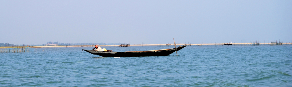
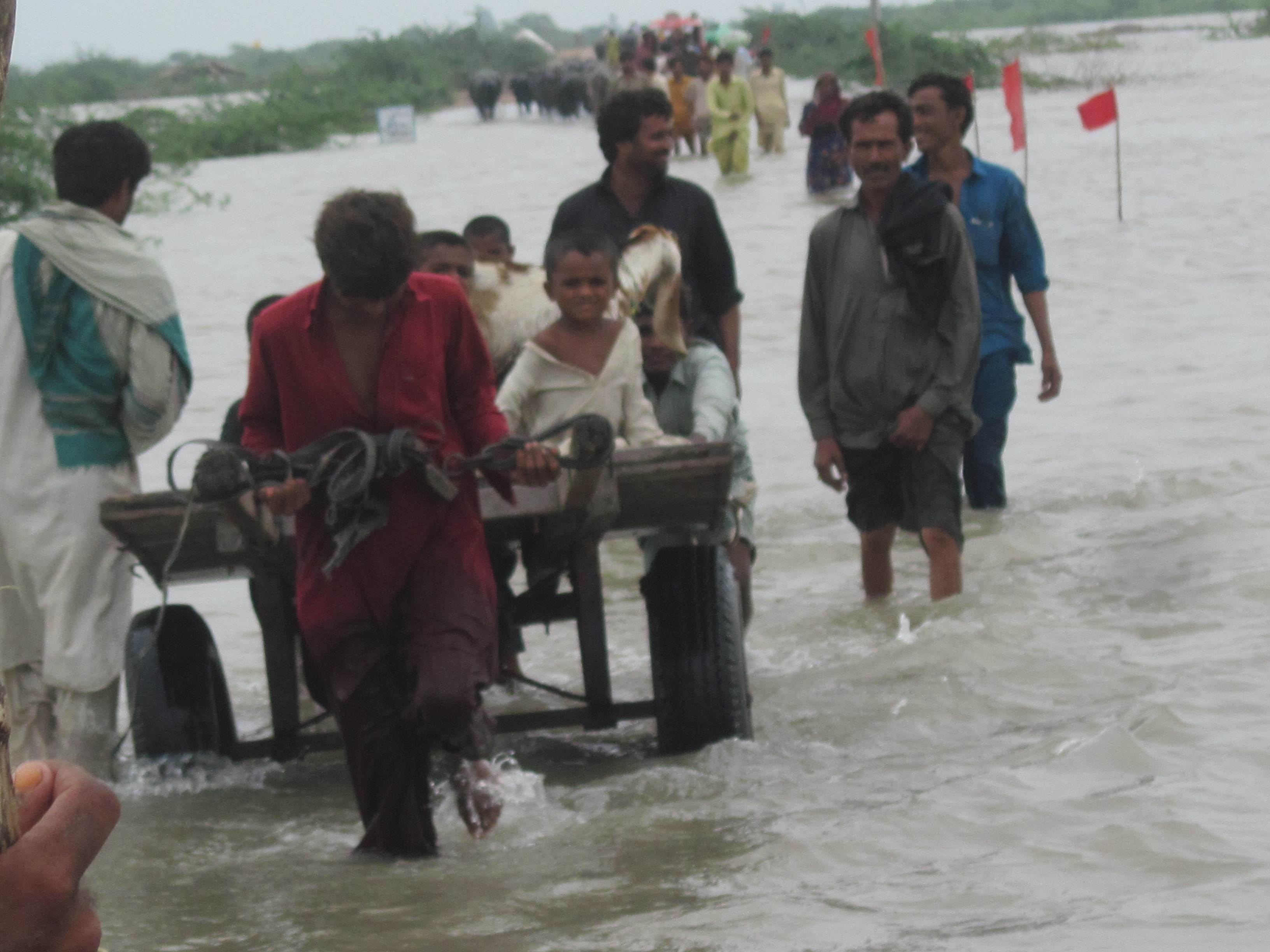
The seas are rising around the Sundarbans. That is old news.
Two islands in this 100-odd island conglomerate have vanished from the face of earth. Even that is old news, met with a stoic shake of the head by environment refugees who now inhabit Sagar, the biggest island in west Sundarbans. For them ‘climate change’ is just another phrase that NGOs and people from the media use to describe everything that is wrong with their lives.
In their life full of challenges, the loudest alarm bells ring almost before each monsoon — of the fury that the sea unleashes between September and November. Severe cyclones — four of which have visited the Sundarbans between 2007 and 2009 — are gulping in more and more land every year. The world’s only mangrove tiger-land is now a constantly shrinking landmass, its existence threatened by severe cyclonic storms, unmanageable demographics, rising seas, coastal flooding and erosion.
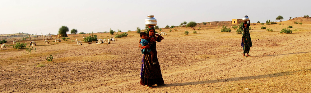
Though just a bit of this fear is reflected in government figures, it is clearly evident in Shamila’s voice. “The fury of the sea now is like never before,” she says standing right where she stood seven years back outside her hut in one of the many refugee colonies dotting Sagar. Shamila has grown from a shy teenager into a confident mother of two and knows where to flee if the going gets tough. “We will go to Kolkata and do something there,” she says talking of her secret dream to settle in the burgeoning megapolis, capital of West Bengal, where “you get beautiful saris”.
Climate displacements
Shamila’s father Sheikh Abdullah did something similar in the late 1990s when he left the sinking island of Lohachara in the vicinity, along with 7000 other refugees from various islands, and sought shelter in Sagar. Lohachara does not exist on the map anymore along with another island Bedford, which never had any human habitation.
Scientists estimate that Sagar will be the worst hit in future with over 30,000 people displaced by 2020 even as neighbouring Namkhana produces 15,000 more refugees. The other islands, all in the western end of the estuarine delta, predicted to face similar fates are Ajmalmari (east and west), Dalhousie, Dakshin Surendra Nagar, Moushuni, Lothian, Ghoramara, Dulibhasani, Dhanchi, Bulchery, Bhangaduani and Jambudwip.
According to estimates, between 2001 and 2010, the net loss of land to the seas across the Indian Sundarbans stands at 63 square kilometre. About 1.35 million people are currently at high risk from sea level rise, storm surges and coastal flooding with a further 2.4 million people exposed to moderate risk.
Sugata Hazra, Director of the School of Oceanographic Studies at Jadavpur University in Kolkata has been studying the seas and listening to the problems of these refugees for long years now. “There have been four cyclones — Sidr, Nargis, Bijli and Aila — in the northern part of the Bay of Bengal in the last part of the decade. Though the frequency of these storms and cyclones has gone down, the intensity appears to be increasing, possibly as a result of rising sea surface temperatures,” he says. Hazra predicts that the 2015 pre-monsoon is going to see another bout of massive flooding.
The pattern appears to be “in line with global climate models which also predict declines in cyclone frequency”, Hazra says. Other scientists studying the trends in the Bay of Bengal say the region has registered 26 per cent increase in severe cyclonic storms in the last 120 years, intensifying post-monsoon.1
However, quick flooding is by far the biggest threat. Slow sinking of islands, on the other hand, takes centuries to get noticed, Hazra says.
The Rising seas
Hazra has been harping on the sea level rise issue for long too, though not many acknowledge this as an immediate threat preferring to call it ‘part of a slow global phenomenon’. “The threat of severe coastal erosion due to relative sea level rise is something that needs immediate attention,” Hazra insists. He quotes an analysis of 50 years of data from three data stations in the Hugli estuary that show a sea level increase of between +0.76mm/year and +5.22 mm/year at different locations in the Indian Sundarbans.2
His own estimation of tide gauge data from the Sagar island observatory between 2002 and 2009 shows a relative mean sea level rise at the rate of 12 mm/year. “In the last 25 years, the rate of relative sea level rise comes close to 8 mm/year, significantly higher than the rate of 3.14mm/year in the previous decade,” he says.
In a recent report he co-authored for the World Wide Fund for Nature (WWF)3, Hazra says besides global warming and the subsequent thermal expansion of water, the rather rapid subsidence of the Bengal delta (2-4 mm/year), compaction of silt and other local causes may be responsible for the exceptionally high rate of relative sea level rise in the Indian Sundarbans.
For the locals, these small numbers do not make a difference. “I don’t know if the sea level is rising. I can see the sea rise during high tide and ebb during low tide,” says Gokul Ghorai, who lives in one of the picturesque islands and sustains his family of five through fishing. “All I know is that the sea keeps pushing our embankements back every couple of years all over these islands.” In 2009 alone, the Aila cyclone demolished about 1000 km of embankments across Sundarbans. “Around 50,000 people left the islands to become labourers in places places like Mumbai and Delhi — there’s no official documentation on how many left,” Hazra says.
Hazra also estimates that the temperature in the Sundarbans will rise by 1°C by 2050 and might have a bearing on the chemical composition of sea water in terms of “increased acidification and decreased dissolved oxygen levels.”
Kumud Ranjan Naskar, a former national fellow of the Indian Council of Agricultural Research (ICAR) and author of several compilations on Sundarbans, feels that the immediate issue at hand is to predict the severe weather events correctly and base the development roadmap of Sundarbans surrounding these events.
“That is much more immediate than climate change, global warming or rising seas,” he says. Naskar, who retired from ICAR a couple of years back and now lives with two 50-feet high Sundari trees in the backyard of his home in suburban Baruipur, not far from the delta, also suspects the theory of subsidence of the Sundarbans. “There is a lot of complex estuarine arithmetic here – to prove subsidence is not so easy.”
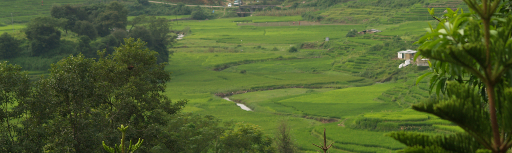
The dwindling forests
The Sundarban delta, formed by the river trio Ganga, Brahmaputra and Meghna, also faces a major threat from discharges of untreated domestic and industrial effluents carried by tributary rivers. A major oild disembarkment terminal in eastern India – the Haldia Port Complex – has been a source of contaminated mud from harbour dredging.
Multiple studies4, 5, 6 over the years have found that chemical pollutants such as heavy metals, organochlorine pesticides, polychlorinated biphenyls and polycyclic aromatic hydrocarbons from agricultural runoffs, wastewater, sewage discharges and agricultural wastes might be changing the estuary’s geochemistry irreversibly and affecting the local coastal environment.
Naskar says it does not augur well for the mangrove plant species Sundarbans is so famous for. Of the 69 species found in India, 63 exist in the estuarine delta and his estimate is that the delta may hold up to 140 mangrove, mangrove associates, back mangrove and coastal zone flora. Naskar, who spearheaded the creation of a natural genepool project in one of the islands some years back, is not so optimistic about the forest cover anymore. “The idea was to preserve one specimen of every mangrove species found across the Sundarbans for posterity,” he says.
Though the genepool might live on, the natural mangrove vegetation and the overall land area has been steadily decreasing.
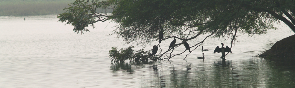
Hazra fishes out satellite maps from his cluttered desk to show comparative images that establish a 5 percent loss of forest cover in the 20 years between 1989 and 2009.
Across the Sundarbans, degraded forests are being replaced by saline blanks, further reducing forest cover. “Climate induced increase in surface-ocean stratification has effects on phytoplankton productivity which may lead to an overall decrease in primary production,” Hazra notes.
On a visit to the islands his keen eye catches new creeks. “Look at the number of streams inside these forests. There are so many more now — the density of the streams is also increasing.”
Warming up to climate change
The West Bengal government, which till recently did not publicly acknowledge the climate change threat to Sundarbans, has made a clear departure in its stand in the last couple of years. A three-year long exercise that culminated in creation of a State Action Plan on Climate Change7, made public last month (March 2013), now underlines the major threat that climate change poses in the delta.
“The ground level workers always knew it. Now the policy makers have also quantified the vulnerability posed to the islands due to climate change,” says Debal Ray, Principal secretary of the state’s environment department and a member secretary of the West Bengal Biodiversity Board.
Ray says the government has initiated a number of scientific studies to understand and predict the influence of climate processes in the estuarine delta and is focussing its effort to “prepare for the inevitable”. “The idea is to create better linkages by constructing bridges for evacuation in times of emergency, to create better mobile phone penetration in the islands for early warning dissemination and to automate weather forecast,” he says.
Damning demographics, food fears
72-year-old fisherman Tapan Debnath, who knows the creeks and forests of Sundarbans like the back of his palm, says he went fishing across the islands and rarely saw large habitations when he was a teenager. “I see people everywhere now, in newer patches of land that were earlier forests,” he says.
The islands have an interesting mix of inhabitants — first generation immigrants from East Midnapore district in West Bengal and parts of what is now Bangladesh, descendants of settlers from the days of colonial administration and a small group of tribal people from Chotanagpur plateau brought to clear forests. In effect, Sundarban now has a very high population density.
According to the WWF report, there is a significant increase in the settlement area from 1226 square km to 1666 square km. Available agricultural land has also reduced and the population crossed the 45,00,000 mark in the 2011 census. The mathematics is simple then — it means an increasing threat to land and food security.
The West Bengal government has taken baby steps in trying to introduce salt-resistant varieties of paddy by providing subsidies to farmers. “Since these varieties have lesser productivity than higher yielding ones, we encourage the farmers to cultivate them on a small patch of land and offer them some incentives. This is one of the top priority things we are doing in the Sundarbans today — to conserve salinity tolerant seed varieties in the face of incessant flooding in the region,” Debal Ray says.
The National Bureau of Plant Genetic Resources hunted for the six locally recalled salt-tolerant farmers’ paddy varieties, but found only two — Hamilton and Matla. The others might have been lost from the region after the “green revolution”, the bureau says, and recommends re-introduction of these salt-resistant paddy varieties in the region to ‘enhance adaptive capacity of the farmers against recurrent salt water inundation’.
Ray says the government will need an outlay of Rs 20, 000 crore in India’s 13th Five year plan period to implement all the well-meaning adaptation and mitigation strategies they have set out in the state action plan. “We can only be optimistic that we get this kind of fund to do what needs to be done to protect the Sundarbans,” he says.
-
References
- Singh, O. P. Long-term trends in the frequency of severe cyclones of Bay of Bengal: Observations and simulations. Mausam. 58, 59-66 (2007)
- Nandy, S. et al. Trend of sea level change in the Hugli estuary, West Bengal. 21st Conference of Indian Institute of Geomorphology. (2008)
- Indian Sundarbans delta. A vision. WWF policy document (2011)
- Sarkar, S. K. et al. Water quality management in the lower stretch of the river Ganges, east coast of India: An approach through environmental education. J. Cleaner Production 15, 1459-1467 (2007)
- Guzzella, L. et al. Distribution of HCH, DDT, HCB and PAH in the sediments of coastal environments of West Bengal, Northeastern part of India. Environ. Int. 31, 523-534 (2005)
- Binelli, A. et al. Concentration of polybrominated diphenyl ethers (PBDEs) in Sundarban mangrove wetland, north eastern part of Bay of Bengal (India).Mar. Pollut. Bull. 54, 1220-1229 (2007)
- State Action Plan on Climate Change, West Bengal (2013)